
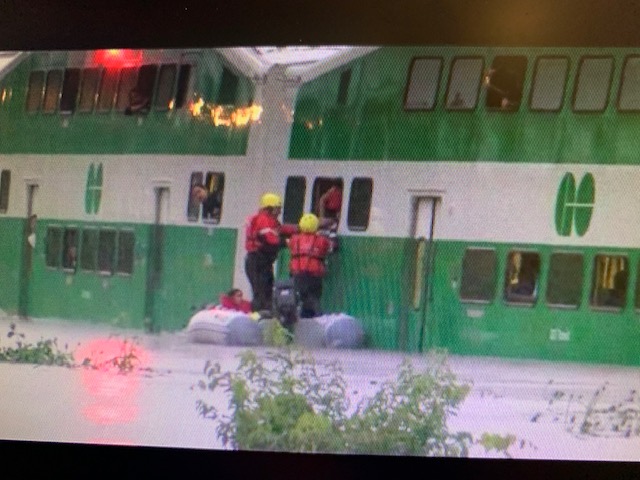
Who will ever forget the 2013 newspaper picture of the black Ferrari submerged in storm water underneath the the Gardiner Expressway? Or the GO train passengers being transported to safety in inflatable rubber boats? Those were times when climate change was just beginning to seem real to those of us who live in Toronto.
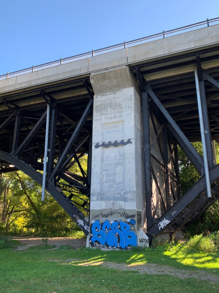
The biggest storm event in Toronto history was Hurricane Hazel in 1954. But our memories of that day are very distant ones, or maybe just recollections of stories our parents told us. We can not fathom how high the waters of the Humber River rose, even though there is a marker way above our heads on a pillar of the Bloor St. bridge. After homes were relocated and damage was repaired, life carried on and the storm water was forgotten by most.
These days, as we read about Fiona and Ian, the reality is just as devastating; and close. We see the downed trees, the collapsed roofs, the pleasure boats tossed around like toys. And we now know that the danger is not far away. Many of us travel to Florida every year, to escape the winter months. As for Nova Scotia, PEI and Newfoundland, well they are part of Canada, for heaven’s sake, not some tropical island in another hemisphere. Storm water will be moving in with us very soon.
Recently our municipal government has begun making contingency plans. I wrote about the Toronto Green Roof Bylaw in a post in February, 2019: Looking UP. At that time there were over 700 green roofs in Toronto, all of them designed to absorb rain water run-off. In July 2020, I told you about a project on Toronto Island: Island Adventure. After high water levels were reported in Lake Ontario due to excessive rain, sandbags were used to form new berms and native grasses were planted – all in an effort to keep the lake water from overtaking the shoreline.
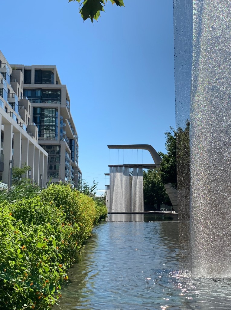
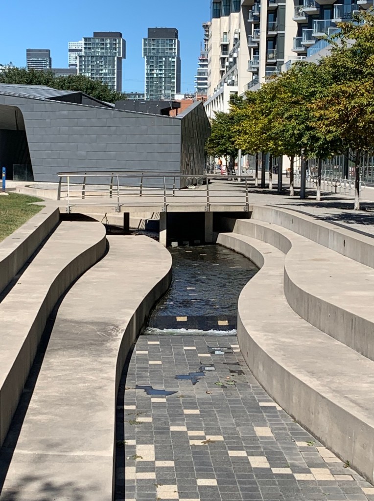
A couple of weeks ago Peter and I went east to look at another municipal project – Sherbourne Common. Storm water is gathered from local communities and treated in a nearby facility, then transferred through 3 towering art sculptures in the form of falls. The water then travels along a channel to the lake where it is released. At the south end of the Common, picnic tables, a playground and a lakeside walkway greet visitors. This is a fine example of science and art co-existing for the public good.
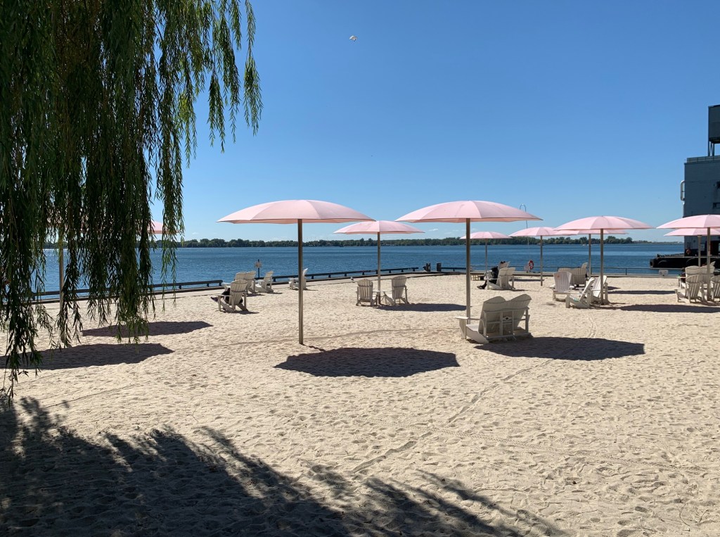
Since we were nearby, we decided to wander over to Sugar Beach. This is definitely not a climate change project – it’s just meant for fun. Although it was built in 2010, we had never visited. Somehow the idea of a hot sandy beach with no place to swim did not appeal to us on a humid summer day. But on a cool fall day, with the wind blowing through the trees – that was much more inviting. Tourists and residents were soaking up the sun, reading a book, or sipping on coffee. Kids played in the sand with trucks and diggers. Everyone seemed to sense that the cold dark days of winter weren’t far off. Season change is also with us.
This week, while you are remembering your Thanksgiving dinner with family and neighbours, give storm water a thought. It’s our new neighbour too.
Sue

Hey guys I remember Hurricane Hazel. I won an award for delivering my Toronto Star paper route in the rain. Interesting history Susan
LikeLike
Awesome pictures! What a fascinating piece on places in Toronto I have not visited, and of course insightful as always. About the great dangers we face if we don’t do something immediately. Thank you, Sue.
LikeLike